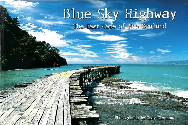
Blue Sky Highway
A pictorial journey around the East Cape
Published in 2006
In 2006 I put together and printed my third book of photographs which I titled Blue Sky Highway. It was a pictorial journey along State Highway 35, the road that connects Gisborne to the Bay of Plenty via the East Cape of New Zealand's North Island. Optimistically I printed 5000 copies. That's a lot of books, specially when they arrive by truck on two full pallets. There were 156 cartons each containing 32 copies of the book. This book was the most popular of the four coffee-table style books I have published and it sold out within six years. I wish I had printed more. In my 20 years of publishing I created four books and in total I have sold around 18,000 copies. It began in 1999 when I decided I needed something to make my fortune with from the thousands of visitors who were predicted to be heading to Gisborne to celebrate the turn of the millennium. There were forecasts of traffic being backed up as far as Opotiki with hordes of tourists expected to descend on our quiet little city, based on the premise that we were the first city in the world to see the sun each new day. The Council gave the main street a million dollar make-over and I printed 5000 copies of The Sunrise Coast: Gisborne and the East Cape. New Years Eve of 1999 turned into New Year's Day of 2000 and the world didn't end, computers didn't shut down and not a lot of people arrived in Gisborne. I was stuck with thousands of books. But what happened was that Gisborne people started buying them and the book quickly sold out. It was such a success that three years later I published a second book titled Under The Sun: Gisborne New Zealand—A Photographic Celebration. And three years later the 5000 copies of that book were almost sold out and I decided to keep the ball rolling with Blue Sky Highway. I printed a fourth book when that title sold out, Gisborne: A Place By The Sea which is currently still available. This story is the introduction I wrote for Blue Sky Highway.
Highway 35 breaks off State Highway 2 at the Jolly Stockman Hotel intersection, just south of Gisborne, and loops around the East Cape of the North Island of New Zealand to rejoin Highway 2 outside the Hot Bread Shop Café on the fringe of Opotiki. About 335 semi-circular kilometres in all.
This book is a collection of photographs taken “up the East Coast” and “down Highway 35” over the past 28 years (that was in 2006). My earliest forays on the Coast were initially recorded in black and white. My job at that time, from around 1979 to 1986, was news photographer for the Gisborne Herald. The magnificent blue skies and vivid green hills represented in this book did not become photographically evident until the 1990s.
In those early 1980s reporter David Conway and I had a journalistic obligation to meet the requirements of a monthly feature within the Gisborne Herald titled East Coast Topics. Our modus operandi was simple and effective. Get in the car and get up the coast. We explored the lengths, breadths and heights of the East Coast in pursuit of stories and photographs—two to three days every month—for going on seven years.
Each trip we became more and more aware that we were venturing into a geographical and social time-warp, eye-witnesses to a way of life that was long past in most other parts of the country—and that all we observed and reported was fleeting, bound for the more obscure pages of New Zealand’s history. While our innocuous little newspaper column was designed basically as a forum for country gossip and the light issues of a network of isolated rural communities, we often found ourselves in the frontline of what was, in effect, a civil war.
It was the decade of “The Burnings”—and during those years we witnessed and often photographed, murder, savagery and violence that was unprecedented for the times, warranting international media attention.
Parallel to this bizarre insurrection we reported and illustrated the minor controversies and important milestones of the resolute people who dwelt along Highway 35—people struggling to make ends meet in a time long before proximity to a sea view had much economic credence.
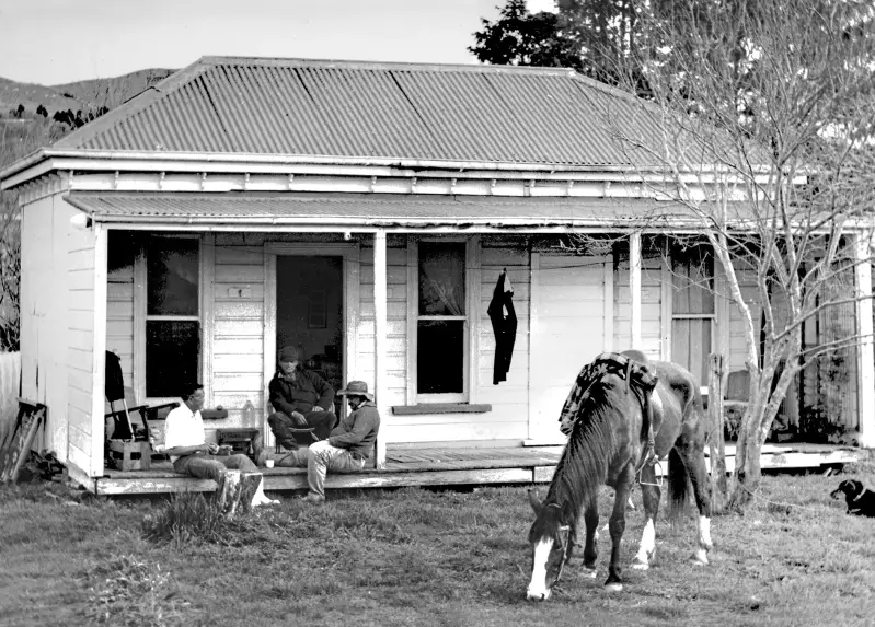

Two of my favourite pictures from the East Coast taken during the early 1980s while working for the Gisborne Herald.
Needless to say, we made many long-standing friendships with the people we met on the Coast. From landowners and political leaders, to the unemployed and desperately poor—all bound by a love of “The Coast” that was the leveler of them all. Ngoi Pewhairangi at her home at Tokomaru Bay showed us how to make a “hangi for two” using a wok, three stones and a wet tea towel. Jan Hughes treated us like long-lost sons and always had our favourite sandwiches ready for lunch when we called in to find out what was making news in Ruatoria. We spent hours philosophising with wise men like Phil Aspinall at Tokomaru Bay, David Goldsmith at Hiruharama and Bob McConnell at Te Araroa. Lou Tangaere piggy-backed us across a flood swollen river to his home for lunch. We sly-sipped rum from a hip flask with Beau Rasmussen and Dudu Fox at the Rangitukia rugby grounds. We were accepted as honorary members of the East Coast rugby squad. I attended the tangi of George Nepia.
Most of the old people we met then—who were the living legends of their time—are now no longer alive, leaving behind their legends and taking with them the amusing and intriguing first-hand memories they shared with us about life on the East Coast in their “good old days”.
My own halcyon days on the Coast ended mid-80s with a move away from Gisborne to pursue my career on a more golden coast and I wasn’t to return until the early years of the 90s. This time my interest was still photographic but from a different perspective.

Exploring the coast and taking photographs from surf skis. This photo shows my adventurous friend Owen Williams paddling through the archway through Mitre Rocks off Cooks Cove.
With publisher and fellow journalist John Woods I helped produce New Zealand Adventure Magazine from his home office at Wainui Beach and for several years we struggled to publish six issues of the magazine a year. We pioneered the concept of “adventure” as a recreational pursuit and as a specialised niche in New Zealand’s tourism industry. We tested new outdoor pursuits, and the equipment involved, around the Gisborne region. In doing so I rediscovered the East Coast—this time by mountain bike, sea kayak, raft and on foot. Surfing too, of course. And a big part of my job was to take pictures. So I began to accumulate, unpremeditated at first, a collection of scenic photographs of the East Coast.
At this time, before the advent of digital photography, to get the best images for scanning into pictures for a magazine I had to use transparency film, also known as slide film. And I also discovered Fuji Velvia, a then new film product that produced images of intense colour, so much brighter than the dull Kodachrome colours of the same era. Fuji Velvia actually allowed me to capture the true colours of the unpolluted sea- and sky-scapes of the East Coast. The blues were so vivid, tropical almost; hence the title Blue Sky Highway.
From the heights of Mount Hikurangi to the rocky islands off Tolaga Bay I roamed with my camera in my backpack. During the nineties I walked the coastline, beaches and headlands from Gisborne to Waipiro Bay. I also paddled much of the same coastline by surf ski and sea kayak. I spent numerous summer days and nights driving Highway 35, camping on beaches, rising at dawn for the best light. I once drove to the East Cape lighthouse from Gisborne, slept in the back seat of my car, woke up to photograph the sunrise, and drove home again.
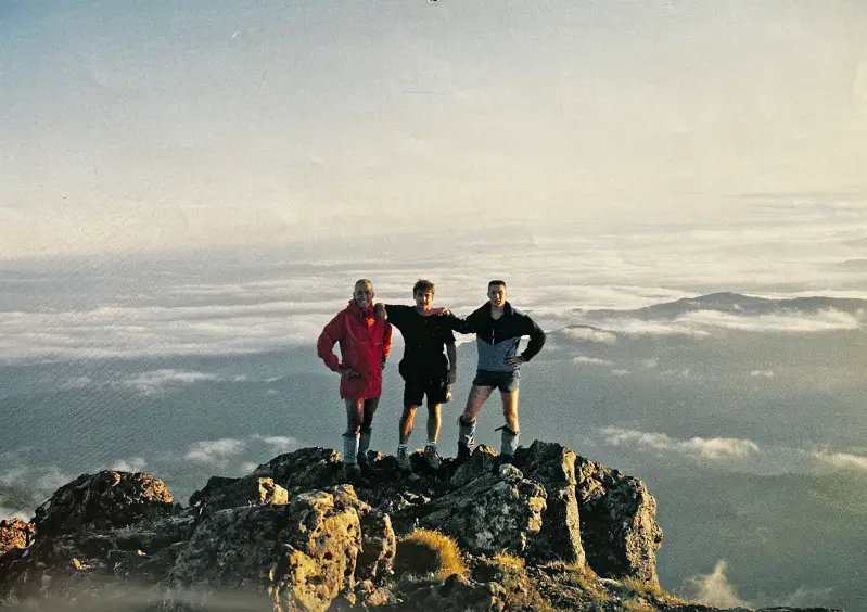
On the summit of Mount Hikurangi in the early 1990s with Craig Pearless and Derek Sarney.
Later, regular long weekends surfcasting at Te Kaha and Omaio provided a new excuse to get along the Highway and nowadays I look forward to an annual pilgrimage to the East Coast Open Golf Tournament as Te Puia. An event worthy of a book on its own.
A road trip around State Highway 35 has various perspectives. It depends where you are coming from, and where you are going to. Both literally and figuratively. From Gisborne, which has mostly been my perspective, it has always been described as “going up the Coast”.
From a Gisborne outlook also, the East Coast—as a place and as a culture—doesn’t really start until you turn inland from the string of beaches just north of Gisborne. However, “State Highway 35”, which has a culture running parallel with that of the “East Coast”, has been popularised in recent years and extends the mystique of the East Coast to include the city of Gisborne and its nearby beaches. Wainui, Makorori, Tatapouri, Turihaua and Pouawa can now justly claim their piece of Highway 35’s celebrity.
Highway 35, as a place in the mind, rather than as the numerical identification of a national road route, was established cleverly by author John Woods in his book Highway 35: Travels Around East Cape, published in 1998. That book is now a collector’s item and is a wonderful insight into some aspects of coast life as Woods saw it at the time. Woods chose Peter Quinn, a photographer more celebrated than myself at the time, to illustrate his saga. I must admit I was disappointed not to have been given the job and felt that Quinn’s rather dark interpretation of the Woods’ story, while outstanding photo-journalism, didn’t do the Coast any favours, and my own book was somewhat motivated by my desire to let the sunshine in.
I have lived on and near Highway 35 nearly 40 years (update that to 60) . I love this coast; from my own quarter-acre of it at Wainui Beach all the way to the rocky coves and tiny villages of the eastern Bay of Plenty. This book is for people who share that love. It is not meant to be a definitive photographic thesis but more a cheerful collection of scenic snapshots taken along a winding highway, under a brilliant blue sky.


Above: A half dozen of my favourite images from Tokomaru Bay.


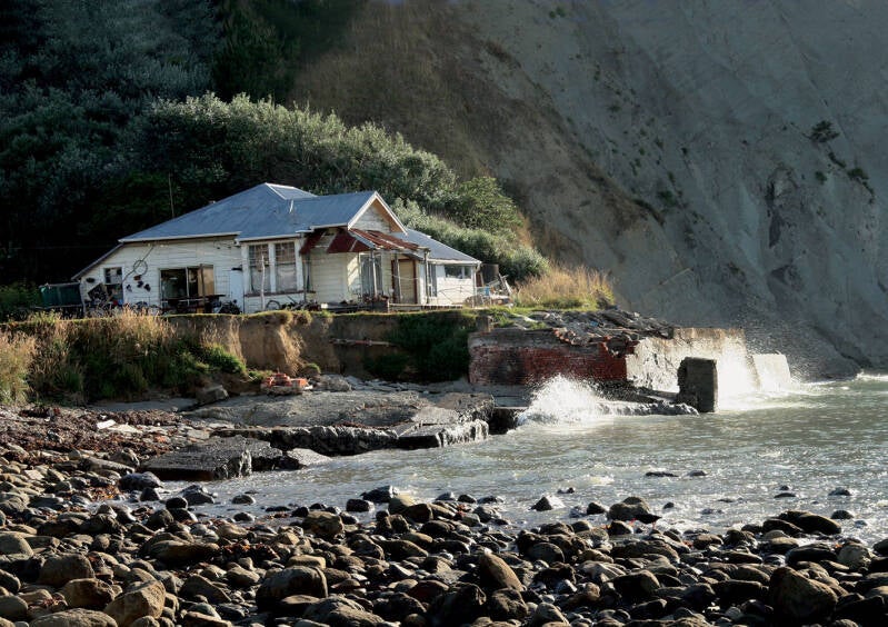
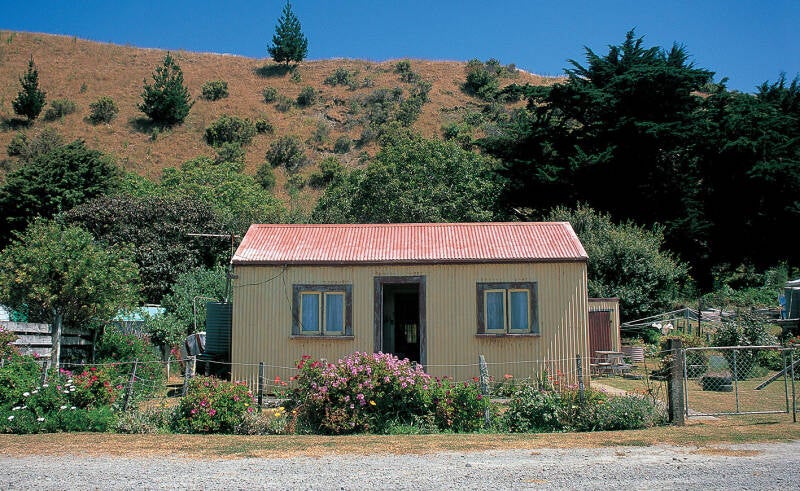
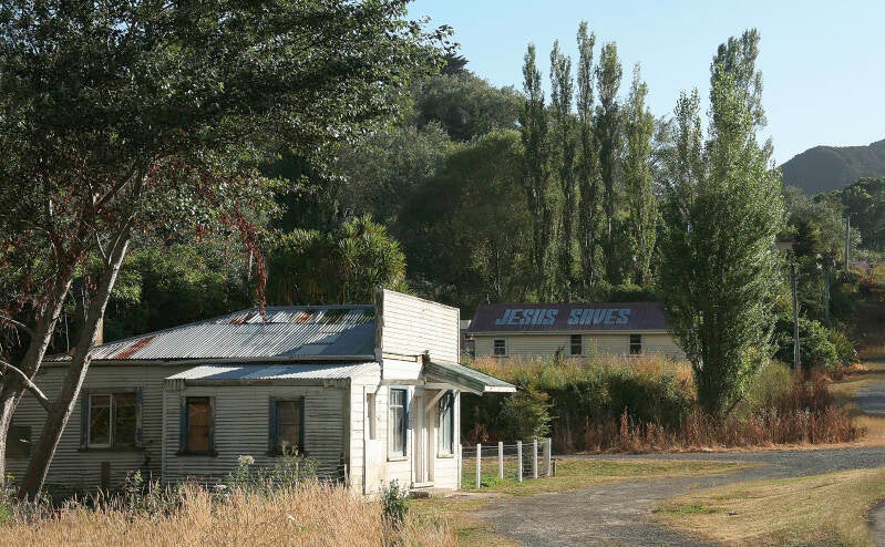
So much of the character of the East Cape is provided by the buildings, many now long gone.


Hikurangi looms large in the landscape around Ruatoria and Te Puia Springs.